
Revere Heritage Site Evolution Part 2
By Guest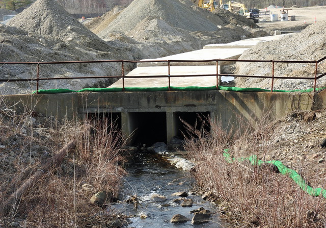
By Rich Trotto
As discussed in the first installment of this series, the Canton River — also known as the East Branch of the Neponset River — was moved underground when waterpower was replaced by electric power for industries at the present-day Paul Revere Heritage Site.
When waterpower was no longer required, the Canton River was moved underground through a triple box culvert. The entry point for the culvert is the only section currently visible. The photo shown above was taken while the culvert was still exposed for inspection on April 11, 2017.
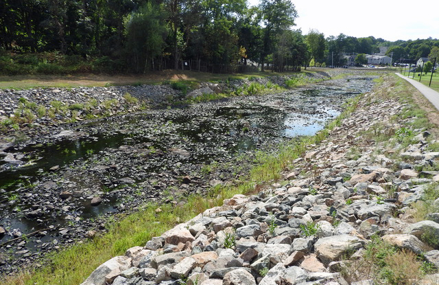
Over time, while the Canton River was on the surface, it overflowed its banks, flooding the industrial site numerous times. A historic flood photo will be in the next article in this series. In 1962, the Army Corps of Engineers built the diversion channel that runs beside Neponset Street around the Heritage Site. A dam was built with a 3/4” lower side to always continue to feed the triple box culvert and a wider section to divert excess flow to the diversion channel safely.
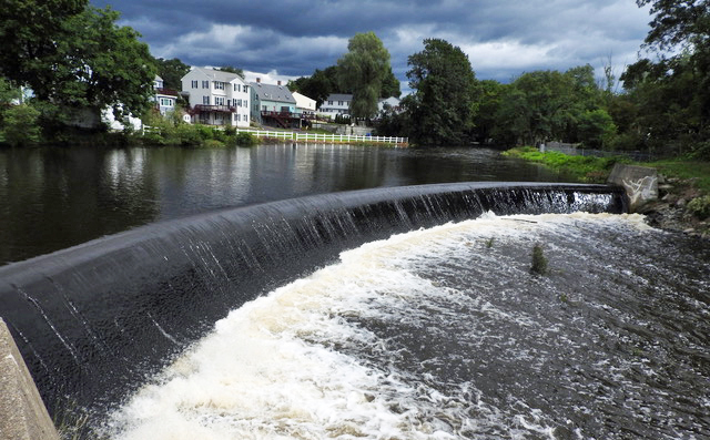
In the photo above, taken on September 2, 2021, heavy flow is shown over the diversion side of the dam after Hurricane Ida dumped four inches of rain across the region. In the photo below, the diversion channel is just puddles while the box culvert continued to flow during a dryer period. The town is required to keep the channel clear of bushes and trees that could trap debris and block the free flow of flood water.
Rich Trotto is a longtime resident of Canton and a frequent contributor to the Citizen.
Short URL: https://www.thecantoncitizen.com/?p=134173


 Posted by Guest
on May 28 2026. Filed under Featured Content, Opinion.
Both comments and pings are currently closed.
Posted by Guest
on May 28 2026. Filed under Featured Content, Opinion.
Both comments and pings are currently closed.