True Tales from Canton’s Past: Taunton Road
By George T. Comeau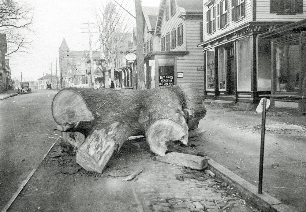
The big elm tree cut down in the street at 535 Washington Street near Ketchum’s Drug Store & Brooks Block in the background (Courtesy of the Canton Historical Society)
It is perhaps our most ancient roadway and most traveled. Washington Street, the main thoroughfare that begins at the foot of the Great Blue Hill and departs at Cobb Tavern in Stoughton. It is a spine that almost perfectly bisects Canton. If there were an East and West Canton, the dividing line is surely Washington Street.
It was a natural footpath that was used by the native population as they moved from hunter-gatherers to a more European-influenced lifestyle. The path became a well-worn and traveled route that early English settlers would have simply adopted. Not unlike the paths that still exist in the Blue Hills Reservation and other more hidden recesses of the town, it was originally less than half the width it is today.
As an ancient road, it was called the “king’s highway,” and without a doubt it was in existence by the middle of the 17th century. It has had many names and the path has changed throughout history. From 1690 through 1694 it was called the “Common Road.” In 1700, it was formally laid out through a petition of the citizens of what was then Dorchester. The deed called it the “Road leading to Billings.” The deed itself is quite descriptive and it would be impossible to trace the original layout through any deciphering today.
The layout in 1700 is described as being “three rods wide,” which is 49.5 feet. More than 300 years later, modern street layouts call for 50-foot-wide roads, no different than our original width of this ancient road.
Deeds prior to modern surveying techniques developed in the early 19th century are treasures of whimsy. In the case of laying out the way in 1700, the selectmen at the time wrote, “We began at Milton line and so marked the way as followeth. In John Davenport’s land we marked a little white oak tree on the west side of the way, next on top of the hill a black oak tree; the next we marked a white oak tree called the brace oak on the west side of the way, marked with an X…” The markings of trees continued — red oaks, grey oaks, and black oaks were all marked with either a single or double white X.
It was no coincidence that oaks were marked. Well known was the fact that ancient Celts worshipped the oak as a symbol of durability, constancy, and purity. Because the oak is dense, its wood is valued for furniture-making and was also used by wheelwrights and barrel makers. But for the men who laid out the way, the oak would be a constant. Oaks, depending upon their environment, can live for more than 400 years. In addition, the men laying out what would become Washington Street also left piles of rocks — “next at a brook called Martin’s Delight (Ponkipog Brook), a heap of stones and rock on the west side of the way.” No tree or original marks from 1700 still exist along this route.
The waypoints in 1700 would have been well known landmarks at the time. They are the who’s who of our earliest settlers. The road passed by the houses of Billings, Davenport, Ephraim Newton, near Henry Willard, and into what is now Canton at Isaac Royal’s land. The layout followed through to Mr. Salter’s door where the 13th milestone stood, and then past Samuel Paul and up the steep hill (near the Canton Corner Cemetery) called Pecunit, past the sawmill, which was the first one established in Canton.
In 1707, it was the “Road leading to Rehobeth,” and by 1712 it was extended and became the “Main road to Rhode Island.” In 1743, it became Taunton Road and then in 1785 it was known as the “Great Road from Boston to Taunton.” By the time that Paul Revere came to Canton in 1801 it was again called Taunton Road. Revere would famously pen a poem called “Cantondale,” which opens with the lines: “Not distant far from Taunton Road, in Cantondale is my abode …”
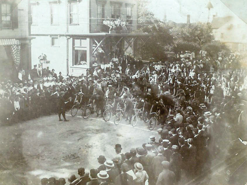
A bicycle race on Washington Street at the corner of Wall Street in front of P. F. Brady Dry and Fancy Goods store in the Flood Building in 1887 (Courtesy of the Canton Historical Society)
In 1840 the street became formally named after George Washington. It was popular during that time to rename streets for our illustrious commander in chief and arguably the father of the nation. There are close to 5,000 streets in the United States named for George Washington, making it the 17th most popular street name in the entire country. If you are wondering what’s the most popular, it’s Second Street. In the case of cartography and street naming, second comes first, owing to the fact that it can be a logical street name after any named main street.
From that point onward, Canton’s main street was named and largely exists along the same layout as it does today.
Along this street were built our schools, houses of worship, factories, retail stores and homes. It is the pulse that has always run through the town. The Stoughton Branch Railroad crosses at Canton Center, and in the heyday of the factories at what is now Revere Street there were several railroad spurs and a nearby trestle to maneuver the enormous orders of iron onto the main branch of the railroad. Along Washington Street there was a trolley line that began at Cobb Corner and could take you straight to Mattapan. At one point the Woolworth, A&P, Post Office, and nearly 100 retail shops lined Canton Center along the street.
Chestnut trees came to line the thoroughfare and they became enormous icons of the successful downtown. By the 1940s these trees had given way to a street widening project and the blight that swept all of New England. There was a beautiful railroad depot that sat near the Norfolk County Bank. Behind the station was a feed and grain store and a Railway Express office. The town doctor lived in the Rice Building, and of course Memorial Hall and the library both front upon Washington Street.
Large, elegant commercial buildings graced our downtown. Three-story wooden buildings eventually were replaced with gothic style brick structures. The social scene centered upon this street with every kind of entertainment you can imagine. A movie theater, performance spaces, a bowling alley, at least two hotels and rooming houses all lined the center. The Irish would gather at Massapoag House and the Italians would gather at their club on the corner of Neponset and Washington. In the days of the soapbox derby, children would scream down the hill between Bolivar and Revere streets, achieving rocket speeds to the thrill of spectators. Horses were stabled along the center and there were several blacksmiths located there in the 19th century. Just about our entire history of this town intersects with Washington Street.
There is a lineage to this old street and it is tied to the people and a changing society that live along the route. Today we sit in traffic that causes us to curse and honk, but take a moment to know that we are but in a long continuum of riders through the ages that pass along Washington Street.
Short URL: https://www.thecantoncitizen.com/?p=45014