
True Tales: Water Problems
By George T. Comeau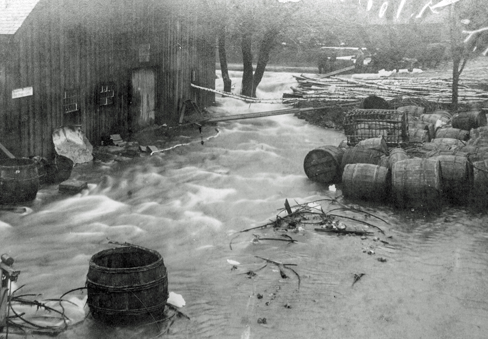
Historic flooding in the 1880s seen at the Revere & Son Mill (Courtesy of the Canton Historical Society)
The following is an excerpt from “Water Problems,” the latest installment of True Tales from Canton’s Past by local historian George T. Comeau.
It has been a very wet year. Since the start of July in Massachusetts we have had four tropical systems, five tornadoes (and counting), and more than 21 inches of rain in Boston, making this the second most amount of rainfall for July-August-September on record. Our local rivers and streams burgeoned with water, and in some cases overflowed to flood stage.
Historically speaking, the term “on-record” is important to note, because systematic record keeping regarding flooding only began in 1904. That is not to say that there were not “historic floods” that can be researched, but the process of determining the magnitude becomes much more difficult without a process to measure the heights of the floodwaters. An attempt to study the past 300 years of flooding in New England was done in 1964 by the U.S. Department of Interior. The report noted that the “historical flood information would have little merit if it rested merely on the casual statement of a local historian, on the unsupported belief of one hydraulic engineer, or on isolated and scattered bits of evidence. However, when hydrologic specialists have made a thorough search of historical literature concerning most of New England, interviewed hundreds of eyewitnesses at hundreds of localities, and compiled and studied this mass of evidence, a high degree of confidence in the conclusions becomes warranted.”
The 1964 report studied literature and historical records prior to the use of gauging stations. Historical-flood literature abounds in adjectives — “awful,” “great,” “unusual,” “calamitous,” “devastating,” “worst ever” — which have only vague dimensional status. The original witnesses varied in their reactions to floods. Some diarists and newspaper reporters mentioned floods frequently; others apparently mentioned them but rarely. Some witnesses became excited over floods; others reported them calmly. The variety of accounts of floods in the early town histories reflects the interests of the historians and original reporters as well as the significance of the flood events themselves. Diaries preserved in Canton and its antecedents, Stoughton and Dorchester, are no different in their entries on flooding. And given the topology and hydrology of Canton, we had more than our fair share of flooding over the years.
To understand flooding, you have to first understand the water sources in our town. Shaped like a kite, Canton has about 12,000 acres of land mass. Water largely flows from York Street, Sharon and Ponkapoag to our western boundary at the Fowl Meadows. Mentioned as early as 1646, the meadows extend seven miles along our town line. Made up of a thick layer of peat, the meadows and swamps drain into the Neponset River, which winds its way through Milton, Dorchester and into Boston Harbor.
The Neponset River forms the dividing line between Canton, Dedham and Norwood. The western branch rises in Foxboro and the eastern branch is formed by Massapoag, Beaver, Steep, York, Hartwell’s and Pequit brooks. Some of our ponds are quite large — Bolivar, Reservoir, Ponkapoag to name a few. Houghton’s Pond, named Wissahissick by the natives, is a 24-acre, spring-fed kettle hole pond. Technically a lake because it is larger than 20 acres, it is one of the only natural lakes in Canton.
All of our ponds have been created and held back by dams and canals, and hardly any of the natural bodies of water run as they did in ancient times. One good example of a historic man-made change to water flow is the artificial canal that was cut into Massapoag Brook in 1834, forming Frog Island. A bridle path had been established as early as 1768 to this small piece of land and would have come out on Pine Street. Man has contrived nature to fit the needs of modern industry and development. Impervious surfaces abound such that we have lost control of water. In many cases, we have created our own problems. Subdivisions, paved roads, parking lots, extensive roofs and the like all contribute to water problems …
See this week’s Canton Citizen to read the full version of this story. Special fall promo for new subscribers: Click here to order your subscription today (also available in digital form).
Short URL: https://www.thecantoncitizen.com/?p=76616