
Water dispute threatens developer’s condo plans
By Jay TurnerIs it a pond or a river?
That is the big question currently facing the Canton Conservation Commission with regard to a portion of the Canton River abutting a proposed five-unit condominium project on Plymouth Street — a project that could very well be forced to alter its plans for a second time in less than a year if commission members determine that it is indeed the latter.
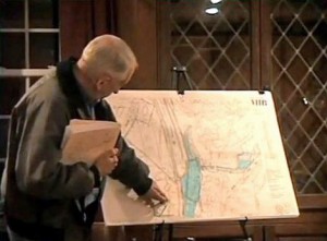
Click the image to view the ConCom meeting (Courtesy of CCTV)
Until recently, both the ConCom and the applicants, Canton builders Don McNiece and Scott Lenhart, had operated under the assumption that the area in question was in fact a pond, thus exempting the property from the stringent requirements of the state’s Rivers Protection Act.
However, following the dismissal of longtime Conservation Agent Bob Murphy in December, new information surfaced that prompted ConCom members to revisit the matter and, ultimately, to reverse course on their previous finding.
According to ConCom Chairman Deb Sundin, the commission had no reason to doubt that the area was a pond after the agent — who has since been linked to an engineering firm that provided paid services to McNiece and Lenhart — determined it to be a pond based on his reading of a resource area study (ANRAD) prepared for the nearby Plymouth Rubber property in 2008.
Sundin said the commission had accepted Murphy’s findings in an effort to be “consistent with what had already been determined.” But after reviewing the ANRAD and conducting its own analysis of the area, ConCom members determined that the Canton River at that location was, in fact, a river, and they reiterated their findings at a hearing on the matter last Wednesday.
“The commission agrees that this is a river and not a pond,” said Sundin, “which is why we asked you to file under the Rivers Act, and it appears the [Department of Environmental Protection] agrees with us. Based on their comments it seems as though you would need to submit an alternative plan and an alternatives analysis.”
ConCom member Tom Liddy, a wetland scientist, later reaffirmed Sundin’s statement while noting that the water in that area has “riverine characteristics,” including “unidirectional flow.”
“From my opinion, I would vote that it’s a river and therefore has riverfront area,” Liddy said, “and you would need to address the performance standards for development of a riverfront area.”
Liddy added that under the state regulations, the developer would only be permitted to develop 5,000 square feet of land in the riverfront area, and in order to exceed that figure, they would need to show that there is “no economically viable alternative” to their existing plans, which call for five condominiums spread out over three separate buildings.
But despite the ConCom’s seemingly firm position on the matter, Arthur Borden, engineer for the developer, made it clear last week that the applicant is not ready to concede the point.
“Our contention is that it is still a pond and not a river,” Borden told the commission. “That’s a pond; whether it’s named or not, that’s designated a pond on the USGS map.”
Borden said the area in question is actually a “diversion channel” — in essence, a manmade pond — that was constructed by the Army Corps of Engineers in the 1960s for flood control purposes.
He also provided additional data in the form of past DEP decisions and disputed the accuracy of the Plymouth Rubber ANRAD.
“I ’m going to submit this supplemental data to DEP before I do anything,” he said, “making our case that it’s not a river, it’s clearly a pond. By definition of the Wetlands Protection Act, it’s clearly a pond; two administrative law reviews, it’s clearly a pond; the Army Corps, their review and their plan made it a pond with the work that was done out there, so we’ll make that case to DEP.”
Sundin, in response to Borden’s remarks, questioned why the developer went ahead and filed a notice of intent with DEP as ConCom had suggested, which to her indicated that they were conceding the area was a river.
Borden, however, said they chose to file the notice in order to give the commission an “opportunity to review it.”
“But in the process of doing that,” he said, “we discovered all of this additional information that flies in the face of the ANRAD. This clearly is not the Canton River regardless of what anybody wants to call it.”
With the two sides seemingly at a standstill, Borden requested that he be given time to review his case with DEP, and ConCom complied, continuing the hearing until April 3.
Several abutters, many of whom have been critical of the project, also attended last week’s hearing, although no one stood up and spoke.
Short URL: https://www.thecantoncitizen.com/?p=19218