
True Tales from Canton’s Past: Ghosts in the Woods
By George T. Comeau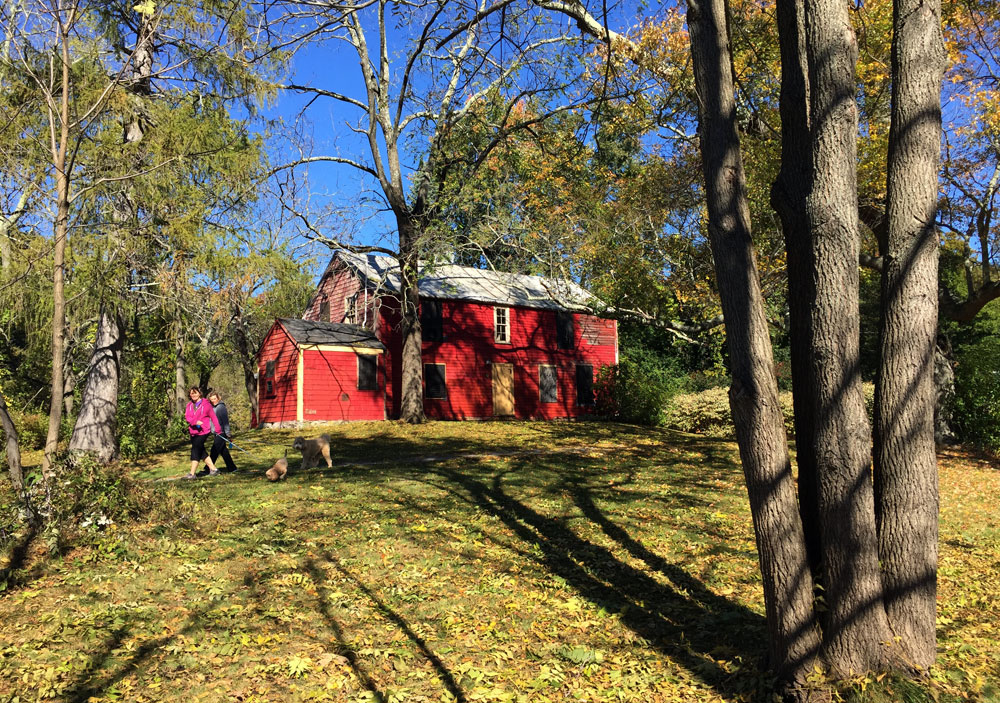
At Pequitside Farm an ancient road passed directly in front of the Tilden House.
In just a few days the ghosts and goblins will be knocking at the door. The season for tricks and treats is upon us, and while the weather is still pleasant, there are a few “ghosts” you can visit before the first snow flies. Well, not actual ghosts, but “ghost roads,” those long forgotten paths that are disappearing slowly into the landscape.
The first ghost road is still relatively easy to see and to understand why it was such a great olden road. Travel up Pleasant Street from Stoughton and just after the Canton Reservoir take a left into the parking lot at the soccer fields on lower Pequitside Farm. On this same piece of land in 1725, David Tilden received a deed from the Ponkapoag natives for 20 acres of land on the west side of Taunton Old Road and on the south by Pequit Brook — pretty much the whole of today’s Pequitside Farm. Tilden built his house on the most southerly side of the property and close to the brook for ready access to water. And right in front of his house was a road that passed just a few feet from his front door. If you think traffic is bad today, consider the fact that Tilden complained to the selectmen of what was then Stoughton about the carts passing so close to his house and creating a nuisance.
The road that passed by Tilden’s homestead is now a hiking trail, and if you deviate from the path and duck under a fence you can continue onto the private property of Mass Audubon. Within a short time you will end up at present-day Washington Street. This ghost road that dates to the earliest footpaths of native man was one of Canton’s original “east-west” roads.
Since what is now Pleasant Street is really quite ancient, it is no surprise that another of the ghost roads is also off this same way. Burr Lane was likely also an old footpath that was in existence in 1732. And only within the past 40 years or so has it also given way to modern development and subdivisions. The stub on Pleasant Street is still there; look carefully and a dry dirt road is all that remains. In our history, this was another east-west road, eventually connecting to the Turnpike — today’s Route 138. Just off this lane is an unmarked Indian burying ground that is protected through preservation restrictions. In its original form it led past beautiful apple orchards and prized farmland.
Another great ghost road is Back Street. Today you will be trespassing almost entirely on private property, but the vestiges of this ancient north-south route once began at present-day Green Street. Before Route 128 cut through and long before modern roads, you could travel from the foot of the Blue Hill clear across to Walpole Street and into Sharon. This is Back Street, laid out in 1738, and still in the woods off Elm Street this road sits abandoned. My favorite stone bridge, hidden now for a few hundred years, is the starting point, and Back Street parallels much of what is now Elm Street but then was called Pakeen Road. The road that once cut through meadows and bogs now cuts through new subdivisions and in a much twisted way comes out at Chapman Street, continuing to the Viaduct and picking up at Walpole Street. Much of Back Street is now developed, but the original route is still extant on what is now Pakeen Farm.
Then there are ghost roads that are better known as “paper streets,” owing to the fact that at one time they only existed on paper and not in reality. Over time the paper streets became actual streets with houses and utilities as land was divided off and needed frontage had to be on actual pavement as opposed to paper. Off Indian Lane are several examples of such roads: Downes Avenue, Tucker Road, and Upham and Wentworth streets. These all date to the late 1800s and were part of a development scheme for cottages. These cottage lots were all 20 feet wide and numbered in the hundreds. Over time the lots were combined, the roads somewhat improved and houses built. In reality, it is quite likely that these were old cart paths that crisscrossed the area of the farms.
Today, on Indian Lane there is a beautiful cart path still visible and hikable. Park on Chief Lane and walk north just a few hundred feet and look carefully for this unnamed ghost road. If you follow it back, you are on land owned by the Canton Historical Society and the walk yields access to the Indian Lane Burying Ground. There is no name for this cart path, but elders always referred to it as the path to the “pig farm.” Anyone who has ever smelled a pig farm can well imagine why such a path is in the deepest and furthest reaches of the town.
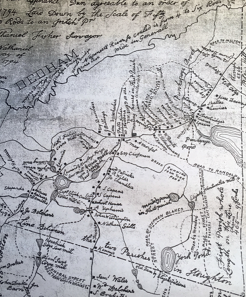
A map from 1796 shows just how few roads there were in Canton at the time. (Click to enlarge)
And anyone who has extensively hiked through the Blue Hills Reservation has encountered the granddaddy of all ghost roads — an actual highway! Where I-93 meets I-95 is an abandoned cloverleaf. As one writer put it, “It’s a telling symbol of our own occasional indecision about what we value more: technological conveniences (automobiles, in this case) or coherent, livable communities.” What we find in the meadows and woods is an odd jumble of curbs, drains, catch basins, and the vestiges of a six-lane highway.
The cloverleaf is like a post-apocalyptic landscape in the woods. It was constructed between 1962 and 1968 and is the northern half of what was originally intended to be a fully working interchange between a proposed Southwest Expressway and the Yankee Division Highway. Curiously, it was old Yankee money that halted the project. Technology writer Wade Roush describes the plans thusly, “The state’s highway blueprints called for the Southwest Expressway to continue about 10 miles north into Boston. It would have barreled through farmland and residential neighborhoods in Milton and joined up with the American Legion Highway, which would have been converted into an expressway running along the eastern edge of Franklin Park. From there, the expressway would have turned Blue Hill Avenue into a six-lane gash through Roxbury and Dorchester, eventually connecting with I-695 near the present-day intersection of Massachusetts Avenue and Southampton Street.”
It was families in Milton and Canton that effectively ended these grand plans. Most notably, it was lawsuits by the descendants of Augustus Hemenway who had considerable land holdings that would have been affected by this road through their pristine land. In fact, today, one of Canton’s only cranberry bogs is hidden in what would have been a direct path of this superhighway. The road was never completed, and I-695 was never built. And so all that is left is this apparition in the woods of what would have been, but for wealthy preservationists.
Yet perhaps the best ghost road is the one that has come back from the dead. This was known as University Road. And although it is not in Canton, it exists because of Canton and the power of the Revere family.
When Paul Revere died in 1818, his 11th child, Joseph Warren Revere, and grandson Frederick Walker Lincoln took over the business. In those early days the copper was carted out of Canton over the highways in wagons drawn by ox teams — the barn for which is being preserved as part of the Paul Revere Heritage Site. Access to the railroad would prove to be a boost to the business, and Joseph Warren Revere became one of the six-member board of directors of the Boston and Providence Railroad as well as one of its principal stockholders. From early in 1834 when William Gibbs McNeill, the chief engineer of the railroad, presented his 11 proposed routes to the commonwealth, Revere lobbied insistently for the route that would bring the railroad through the busy manufacturing town of Canton rather than Dedham. The Viaduct in Canton is more than a coincidence abutting the Revere Copper Company.
Henry B. Chase, a historian from Mansfield, wrote an extensive monograph on the Boston and Providence Railroad. Chase believes “the possibility that certain aspects of this decision (to bring the railroad through Canton) may have been made almost at the last minute is suggested by University Road, which branches in a south-southwest direction off Dedham Street in Canton. Until fairly recently University Road was a cartpath atop a seemingly useless causeway that departed the line of the railroad at the first point of curvature south of Readville, about 260 feet south of the Dedham Street overpass and just south of the Neponset River bridge. This fill, now a paved road, ignores the left-hand curve of the railroad and charges straight ahead in line with the previous tangent for 0.72 mile until it encounters a little neck of ground moraine about 900 feet west of the tracks. But this is not the finish.”
Although the present University Avenue dead-ends at that point, the line continues, or did so before construction of I-95 messed up the terrain, after a very slight left-hand bend to avoid Neponset River, in the form of a footpath through the Neponset marshes for another mile to the former Canton Airport on the northeast side of Neponset Street. The question of this ghost road is whether this 1.82-mile relic was an attempt to avoid the intervening rock ridge and the steep-sided valley at Canton by making use of the Neponset lowlands for a greater distance, bypassing the present site of Canton station by 0.6 mile to the west. We likely cannot know for sure, but if politics could abandon a road in the woods, it is likely that politics could re-route one over the vale of the Neponset River and cause the Viaduct to be built. Whatever the case, the ghost road is no longer a ghost, yet its history remains an intriguing part of our history.
Short URL: https://www.thecantoncitizen.com/?p=31245